File:Vesta map for GeoHack.png
From The Goon Show Depository
Size of this preview: 800 × 400 pixels. Other resolutions: 320 × 160 pixels | 640 × 320 pixels | 1,024 × 512 pixels | 1,280 × 640 pixels | 3,561 × 1,781 pixels.
Original file (3,561 × 1,781 pixels, file size: 3.06 MB, MIME type: image/png)
| This is a file from the Wikimedia Commons. Information from its description page there is shown below. Commons is a freely licensed media file repository. You can help. |
Summary
| Description |
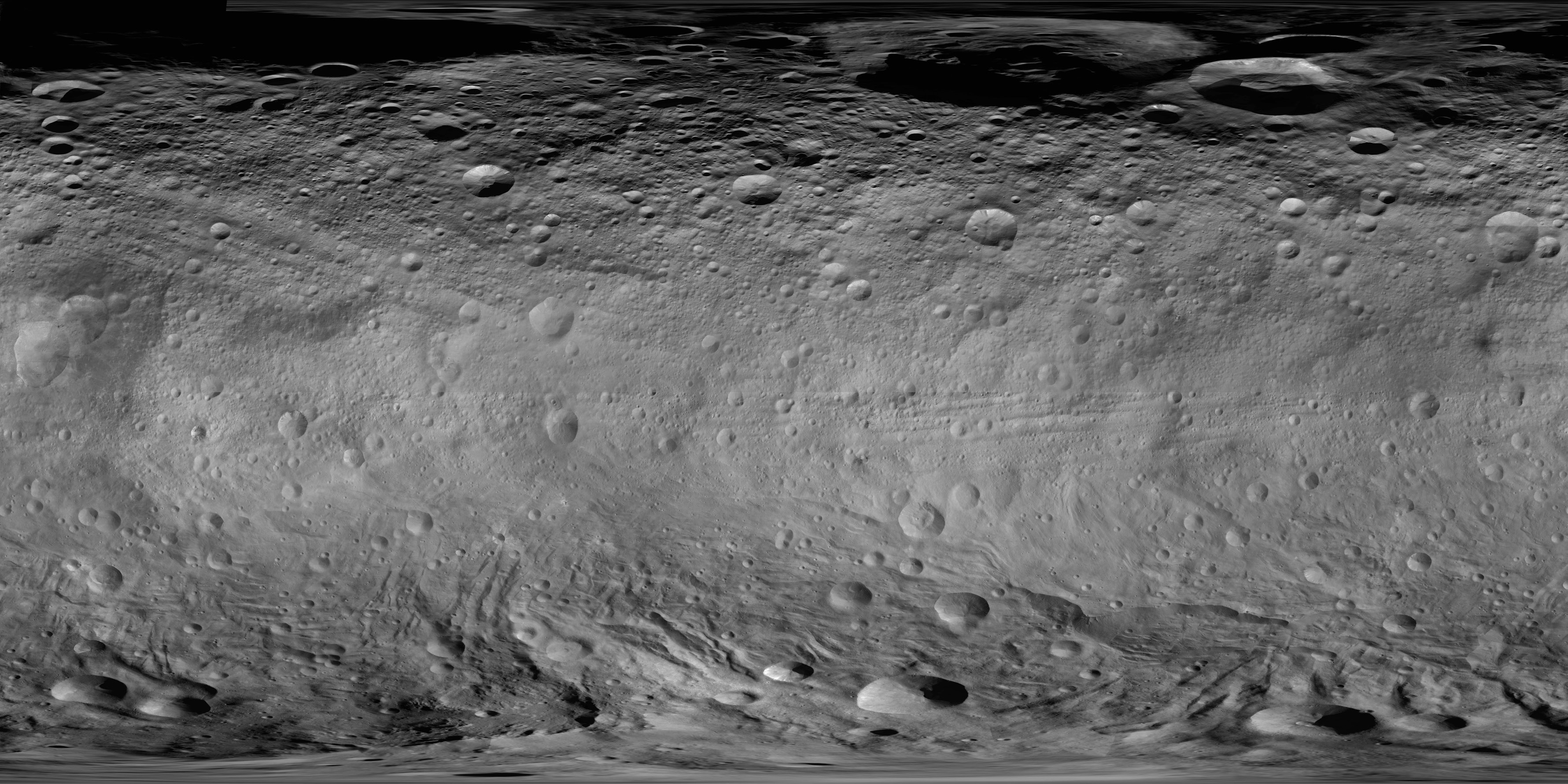
English: Global photomap of asteroid 4 Vesta, based on the Dawn spacecraft's framing camera (FC) imagery. North is up. Image covers 90 degrees north to 90 degrees south; left edge is 330 degrees longitude, with 0 degrees longitude just to the right. For feature names and exact lines of latitude and longitude, see Map of Vesta with feature names.png. For image information, see: Roatsch, Th.; Kersten, E.; Matz, K.-D.; Preusker, F.; Scholten, F.; Jaumann, R.; Raymond, C.A.; Russell, C.T. (December 2012). "High resolution Vesta High Altitude Mapping Orbit (HAMO) Atlas derived from Dawn framing camera images". Planetary and Space Science 73 (1): 283-286. DOI:10.1016/j.pss.2012.08.021. The Vesta cartographic coordinate system used in this map has been recommended by the IAU. |
| Date | circa 2012 |
| Source | https://planetarynames.wr.usgs.gov/Page/VESTA/target / https://planetarynames.wr.usgs.gov/images/vesta.pdf |
| Author | NASA/JPL-Caltech/UCLA/MPS/DLR/IDA |
| Other versions | Original upload by Stepheng3 based on 589450main pia14703-full full.jpg (resized, filled northern hemisphere, and converted to PNG). |
Licensing
| This file is in the public domain in the United States because it was solely created by NASA. NASA copyright policy states that "NASA material is not protected by copyright unless noted". (See Template:PD-USGov, NASA copyright policy page or JPL Image Use Policy.) | ||
 |
Warnings:
|
File history
Click on a date/time to view the file as it appeared at that time.
| Date/Time | Thumbnail | Dimensions | User | Comment | |
|---|---|---|---|---|---|
| current | 02:09, 22 December 2019 | | 3,561 × 1,781 (3.06 MB) | wikimediacommons>Huntster | Specifically uploading over previous image so that the templates that call on this image for mapping purposes can utilize this higher resolution map. |
File usage
The following page uses this file: